Lucas Co. officials concerned about weather forecast
Sheriff Tharp issues Level 3 snow emergency
2/4/2014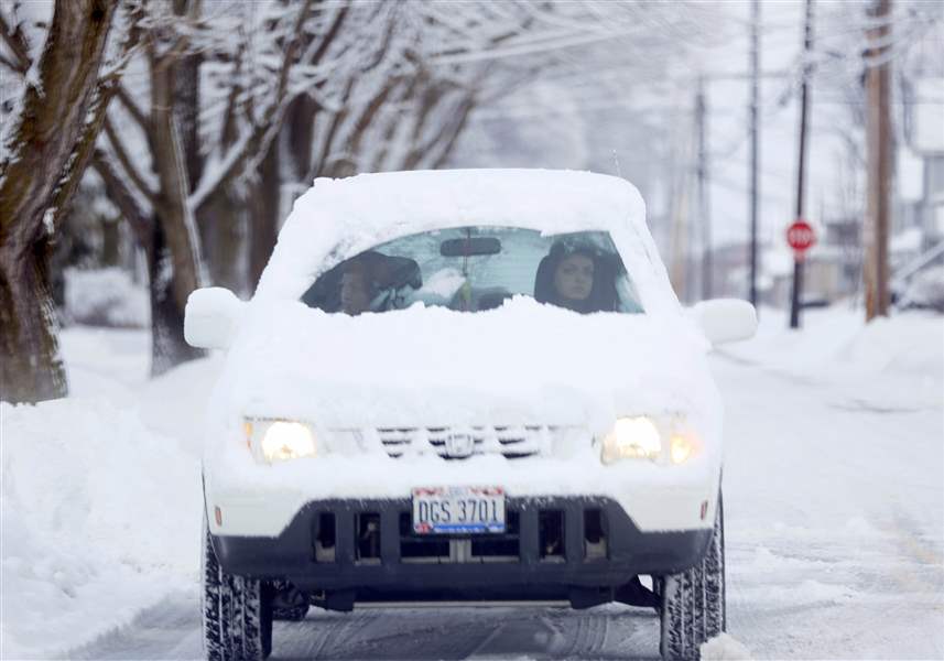
A motorist peers out of a small space on her windshield amidst a pile of snow while turning on to Wooster Street in Bowling Green.
THE BLADE
Buy This Image

A boy races through the parking lot of Gibsonburg High School to avoid the snow after the Ottawa Hills basketball game, in Gibsonburg, Ohio.
Backed by the heads of Toledo and Lucas County government, county Sheriff John Tharp has banned all non-essential travel in the county starting at 11:30 p.m. today in anticipation of the region's fourth major snowstorm this winter.
The sheriff, Toledo Mayor D. Michael Collins, and Carol Contrada, president of the Board of County Commissioners, said they will hold a 5 a.m. conference call to decide whether the Level 3 winter emergency should continue or be reduced to a lower level in time for most people's work days.
RELATED ARTICLE: Potholes remain a big problem in Toledo
The National Weather Service has predicted as much as nine inches of snow by Wednesday afternoon in Toledo, with less snow in Michigan and more to the city's south, as a storm now crossing the Mississippi Valley tracks across south-central Ohio.
Let us know what you think about the upcoming storm and now you're getting ready on Twitter and Facebook with #snoledo.
As of 7:30 p.m., the only other northwest Ohio counties to have issued snow emergencies were Sandusky, Hancock, and Ottawa counties, which have all issued Level 1s. But some towns, including Bowling Green, Northwood, Tiffin, and Perrysburg, had declared snow emergencies so vehicles could be removed from streets.
Keeping most traffic off the roads during what is expected to be the height of the storm, between midnight and 5 a.m., "is meant to get those roadways passable," Mayor Collins said.
He and the others commended residents of Toledo and its suburbs for their cooperation during the Level 3 emergency declared in advance of the city's 13-inch snowfall a month ago.
Announcing the travel ban ahead of time "eliminated the human element of panic" by allowing residents to run errands and stock up on supplies before the storm gets bad, the mayor said.
Sheriff Tharp particularly pleaded with area residents to avoid freeways during the storm because of the risk of collisions with tractor trailers. Big-rig jackknifes can cause "horrible, horrible accidents," he said.
"Take the other roads, keep your speed down to 25, 30 miles per hour, and relax," the sheriff said.

Elise Clark, a psychology major, walks to her car at the University of Toledo. She is going home to Addison, Michigan, a 90-minute drive in a snowstorm.
Law enforcement will not try to keep big trucks from passing through Lucas County during the travel ban, Sheriff Tharp said, although trucks that speed or drive recklessly will be subject to ticketing.
Employers, he said, should pay attention to news reports after the 5 a.m. conference call to determine whether they should curtail operations Wednesday morning.
A winter-storm warning from the National Weather Service office in Cleveland has been effect from 5 p.m. today and will last until 5 p.m. Wednesday for Lucas County and counties as far east as Erie County and as far south as the northern fringes of the Columbus area.
A similar warning from the weather service office in North Webster, Ind., covers extreme northwest Ohio and is effective from 1 p.m. today until 4 p.m. Wednesday. It predicts 6 to 10 inches in the warned area.
But for Lenawee and Monroe counties and areas farther north covered by the weather service's Detroit office in White Lake, Mich., the alert is a lower-grade winter-weather advisory. It predicts 3 to 5 inches of snow, with "isolated" areas of six-inch snowfall near the Ohio border.
In Columbus and Dayton, snowfall totals are expected to be lower because the precipitation is forecast to be a mix of snow, sleet, and freezing rain. An ice-storm warning is in effect for the Cincinnati metro area and the Ohio Valley east of there.
For travel purposes, Toledo's exact snowfall may make little immediate difference. The weather service advised people to "use extreme caution if travel is unavoidable" during the storm, with quarter-mile visibility at times. Winds are expected to rise out of the northeast at sustained speeds of 25 mph by Wednesday morning, causing snow to blow and drift.
Toledo's temperatures are expected to range between the upper teens and low 20s during the storm, then drop into the single digits Wednesday night after the storm's cold front passes.