NWS dispatches teams to investigate possible tornado damage
11/6/2017
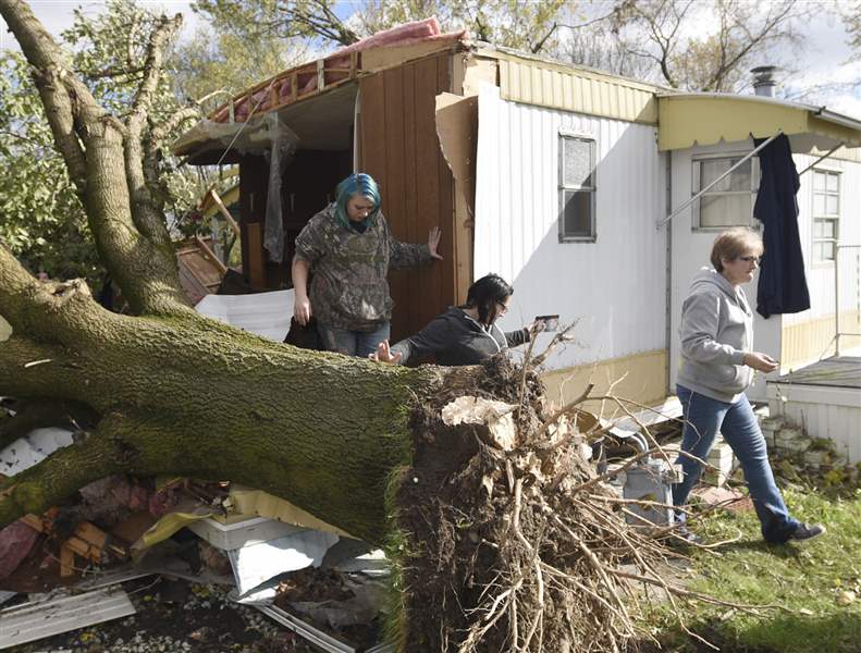
Taylor Curlis, center, leaves the bedroom of her mobile home Monday in Findlay after gathering personal items. A tree ripped the front off of the home during a storm Sunday afternoon.
AP
The National Weather Service office in Cleveland has confirmed four tornadoes Sunday afternoon, two in each of Huron and Seneca counties, during the passage of heavy thunderstorms that also contained damaging straight-line winds.
The strongest of the twisters, packing winds estimated between 111 and 135 mph, touched down about 5 miles northeast of Republic in Seneca County, according to a weather-service summary issued late Monday evening. That tornado's main casualty was a large barn along State Rt. 18 that was leveled, the weather service said.
A slightly weaker tornado about the same distance from Republic but north-northeast damaged five structures just a few minutes later.
Northeast of Willard in Huron County, meanwhile, a tornado with winds estimated between 86 and 110 mph damaged two grain silos and two other buildings, while near Fitchville, Ohio a twister estimated between 65 and 86 mph damaged two buildings and knocked down several large trees.
As of Monday night, the weather service had not confirmed any tornadoes near Findlay, but its storm surveyors said straight-line winds of between 80 and 90 mph had caused damage on the city's north side.
Findlay City Schools were closed Monday, but class was scheduled to resume on Tuesday.
Earlier Sunday, thunderstorm-related winds damaged the roof at the ConAgra food-processing plant in Archbold, Ohio and damaged the football stadium at Wauseon High School, along with downing trees and power lines.
One injury was reported involving a toddler who grabbed a fallen live wire in her family’s Wauseon yard and was shocked.
But the National Weather Service office in North Webster, Ind., which covers Fulton County and neighboring counties in far northwest Ohio, said none of the weather data and photographic evidence received there indicated a tornado.
“It all seems consistent with straight-line winds,” said Amos Dodson, a weather-service meteorologist. He declined to estimate how strong those winds were.
The storms’ heavy downpour caused minor flooding on several area rivers.
First to flood in northwest Ohio was the Portage River, which as of Monday morning was 0.4 feet above its 9.0-foot flood stage in Woodville. The Cleveland weather office said it would crest Monday night at 10 feet and retreat to its banks by Tuesday evening.
The North Webster office posted flood warnings for both the Tiffin River in Fulton, Williams, and Defiance counties and the St. Joseph River in Williams County and adjoining parts of Indiana.
The St. Joseph was expected to rise above its 12-foot flood stage near Montpelier, Ohio early Tuesday morning, crest 0.2 feet above flood stage early Tuesday afternoon, and be back below 12 feet by late evening.
The Tiffin was forecast to rise above its 11-foot flood stage near Stryker, Ohio early Wednesday morning, crest 1.3 feet higher early Wednesday evening, and recede below flood stage by early Friday.
Both rivers’ floods were expected to affect mostly low-lying farmland, although the Tiffin could inundate part of State Rt. 66 north of Archbold.
Contact David Patch at: dpatch@theblade.com or 419-724-6094.