Most powerful typhoon of the year hits north Philippines and south Taiwan, heads to Hong Kong
9/21/2013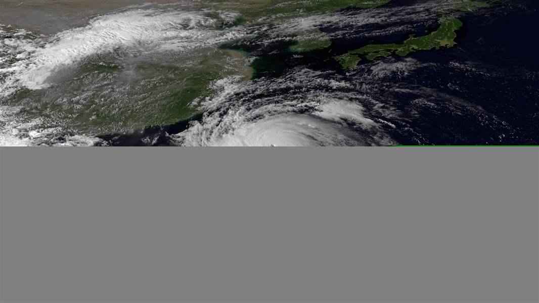
This image porvided by NOAA was taken by the Japan Meteorological Agency's MTSAT-2 satellite at 4:30 a.m. EDT on Sept. 20, 2013 shows Typhoon Usagi. The most powerful typhoon of the year swept through the Luzon Strait separating the Philippines and Taiwan on Saturday, battering island communities and dumping rain as it eyed landfall in Hong Kong. Usagi had maximum sustained winds of 222 kilometers per hour (139 miles per hour) and gusts exceeding 260 kph (163 mph) Saturday morning, and was 550 kilometers (342 miles) south of Taipei, Taiwan's capital, according to the U.S. Navy's Joint Typhoon Warning Center. (AP Photo/NOAA)
ASSOCIATED PRESS
TAIPEI, Taiwan — The most powerful typhoon of the year swept through the Luzon Strait separating the Philippines and Taiwan today, battering island communities with heavy rains and strong winds as it headed straight for Hong Kong.
Typhoon Usagi weakened from a super typhoon — those with sustained winds of at least 150 miles per hour — and veered westward during the day, likely sparing southern Taiwan from the most destructive winds near its eye. No deaths or serious injuries were immediately reported.
By this evening, the storm had maximum sustained winds of 108 mph and gusts of up to 131 mph, and was 94 miles southwest of Taiwan’s southernmost point, the Central Weather Bureau said.
But gusts exceeding 144 mph were recorded on the Taiwanese island of Lanyu, with dangerous winds buffeting the holiday resort of Kending on the Hengchun peninsula as the storm made its closest approach to the area.
The Hong Kong Observatory said tonight that Usagi was 354 miles east-southeast of the city. It said the storm’s maximum sustained winds would weaken to 165 kph (103 mph) as it approaches Hong Kong on Sunday afternoon before making landfall overnight. The observatory was maintaining a No. 1 Standby Signal and warned that the storm posed a “severe threat” to the city.
Cathay Pacific Airways and Dragonair said flights today were unaffected except for one canceled flight, but both airlines said flights to and from Hong Kong International Airport would be canceled from 6 p.m. Sunday and resume Monday if conditions permit.
China’s National Meteorological Center announced a red alert, its highest level, as the storm maintained its track toward the manufacturing heartland of the Pearl River Delta. The observatory warned Usagi would impact coastal areas of Guangdong, Zhejiang and Fujian provinces.
In Taiwan, more than 3,000 people were evacuated from flood-prone areas and mountainous regions as the government deployed military personnel into potential disaster zones. The storm system dumped up to 20 inches of rain along the eastern and southern coasts in a 20-hour period, with officials warning that more than 39 inches could drop before the storm leaves Sunday.
Local officials closed mountain highways blocked by landslides and suspended train services connecting the east and west coasts as power outages and rising floodwaters affected thousands of homes.
Rivers swollen with fast-moving water and debris thrown down from steep and unstable mountain catchment areas threatened bridges on both sides of the island.
In the Philippines, Usagi triggered landslides and power outages in the north of the country, including the Batanes island group, where it made landfall early today. No casualties have been reported.
The Office of Civil Defense in Manila said landslides damaged houses and roads, and pockets of power outages were reported in at least five northern provinces, where several roads and bridges were impassable.
The government’s weather bureau warned that storm surges and heavy waves could cause damage in the Batanes and other islands in the Luzon Strait before Usagi blows past the Philippines on tonight.
Usagi has a massive diameter of 680 miles, with its outer rain bands extending across Luzon, all of Taiwan and more than 63 miles into China’s interior, satellite images show.