ODOT looking at embankments, making repairs
12/10/2017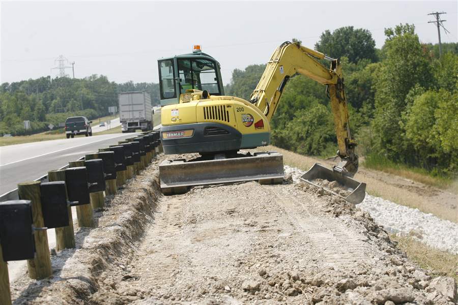
A crane does embankment repair work along SR 2 between Port Clinton and Camp Perry on July 9, 2007.
THE BLADE
Buy This Image
MARBLEHEAD, Ohio — When superhighways like the Ohio Turnpike and State Rt. 2 were built across northern Ohio during the mid-20th century, embankments typically were built directly on top of the topsoil.
It isn’t done that way today, an Ohio Department of Transportation engineer says, for reasons freshly demonstrated by a slipping slope on Route 2 that has closed ramp and, last week, the westbound right lane at the State Rt. 269 interchange in Ottawa County.

A crane does embankment repair work along SR 2 between Port Clinton and Camp Perry on July 9, 2007.
“When the organic topsoil starts decomposing, water gets in and it creates a slip zone,” said Doug Rogers, the district geotechnical engineer at ODOT’s Bowling Green office. “We’ve taken care of our hot spots. The soils out there are very moisture sensitive.”
But while the embankment failure at Route 269 is not the first of its kind in that part of Ohio, Mr. Rogers said, it worsened much faster than others - like one a few miles west along westbound Route 2 near the Portage River - because of the fill material used to build it.
That particular embankment, he said, contains granular fill that “was probably brought in from a quarry somewhere nearby,” and that material “tends to move a little more rapidly.”
Crews from ODOT’s Ottawa County maintenance garage late last week cleared vegetation from the slope “to provide access for survey and geotechnical equipment,” said Rebecca Dangelo, the district office’s spokesman.
A geotechnical drilling crew was setting up at the site Friday to take soil samples and install inclinometers - devices to measure movement in the soil. ODOT also planned to take down a light pole from a vulnerable spot near Route 2’s bridge over Norfolk Southern railroad tracks just east of the closed ramp, Ms. Dangelo said.
“We are gathering data to determine the depth of the landslide feature movement. We also are investigating the condition of the subsurface soils and bedrock below the landslide area,” the ODOT spokesman said.
The ramp was closed Nov. 30 after the collapse started, with ODOT saying at the time it was likely to remain closed until at least August. The ramp’s shoulder had been closed several days earlier.
The right lane closed in the same area last week for precautionary reasons, Ms. Dangelo said. By that time, she said, an open void had been found beneath the ramp lane, but there was no damage to the right lane.
Affected ramp traffic is detoured to the nearby State Rt. 53 North exit.
The failing slope near the Portage River has been sinking for several years, much more slowly, and so far has required just a piece of the westbound shoulder to be blocked with orange barrels.
Repair project for that slip-out is under design and should be ready for construction during the fall of 2018, Mr. Rogers said.
There, the problem is that a causeway embankment filled with heavier rock was placed on “lake deposit” material on the river bottom, and “over the years it’s been settling,” the engineer explained.
Having used inclinometers to measure how the soil was shifting, the transportation department plans to build a “plug tile” wall system with support shafts drilled into “strong material” deeper below the riverbed.
That could also be the solution for the failure at Route 269, Mr. Rogers said, depending on how deep the problem there goes.
For a shallower failure, he said, it could be sufficient to dig out the topsoil beneath the embankment and then rebuild the whole thing with drains to take the water out in the future.
“We’ve got to evaluate how deep this thing is rotating,” the ODOT engineer said.
The largest of the region’s embankment problems involved fill used to build the approaches for numerous local road bridges over the Ohio Turnpike in northern Sandusky County.
Several such roads had to be closed starting in 2007 while Sandusky County and the turnpike argued over who was responsible for repairs. The Ohio General Assembly settled the matter by assigning the work to the turnpike; the county engineer’s office had said it and various townships could not afford to do the work.
The turnpike also had to make significant repairs to an embankment along its own mainline northwest of Fremont at about the same time, while ODOT’s slope-repair sites have included the Route 53 South exit from westbound Route 2 near Port Clinton.
Contact David Patch at dpatch@theblade.com or 419-724-6094.