Nostalgia unfolds for road maps
GPS boom, Web sites, and smart phones change trip planning
7/4/2012
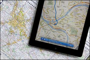
A traditional road map and an iPad both show the Pittsburgh area. Transportation agencies around the country are printing fewer maps because demand is down.
COLUMBUS -- Used to be, Dad would stuff half a dozen maps into the glove box before setting out with the family on a road trip to see the waterfalls at Yosemite or the granite faces of Mount Rushmore. Colorful maps bearing the logos of the oil companies that printed them -- names like Texaco, Gulf, Esso -- once brimmed from displays at filling stations, free for the taking.
But of the more than 35 million Americans expected to travel by car this Fourth of July week, a good chunk will probably reach for technology before they're tempted to unfold -- and in a tradition that used to bind Americans as tightly as a highway cloverleaf, try to refold -- a paper road map.
Web sites such as like MapQuest and Google Maps simplified trip planning. Affordable GPS devices and built-in navigation on smart phones downright transformed it -- and transportation agencies around the country are noticing, printing fewer maps to cut department costs or just acknowledging that public demand is down.
The drop in sales began around 2003, when affordable GPS units became popular Christmas gifts, said Pat Carrier, former owner of a travel bookstore in Cambridge, Mass.
"Suddenly, everyone was buying a Garmin or a TomTom," he said. "That's the year I thought, 'Oh, it's finally happened.' "
Transportation departments around the country are in the middle of reprioritizing their spending amid times of falling revenue, and paper maps could be on the chopping block, said Bob Cullen, spokesman for the American Association of State Highway and Transportation Officials.
In late June, at the annual exposition of the Road Map Collectors Association in Dublin, Ohio, collector Terry Palmer was selling some of his beloved maps. The 65-year-old from Dallas wore a T-shirt with intricate route lines of the United States on his chest, back, and arms.
"The GPS of course now being so available, a lot of new cars are coming out with built-in GPS. People are utilizing those, and they don't want a road map," he said.
In Georgia, officials are printing about 1.6 million maps to cover a two-year period -- less than half of what they were printing a decade ago. In Pennsylvania, about 750,000 maps are being printed -- way down from more than 3 million in 2000.
Officials in Oklahoma and Ohio also say map printing is down, and Washington state discontinued them altogether by 2009 because of budget shortfalls.
But in other states, printing has remained steady because maps remain popular at visiting centers.
It's unclear why some states are affected more than others. Some speculate certain regions affect how people travel there. In Delaware, for example, officials attributed a jump in printing of about 100,000 maps to people visiting beach areas and renewed real-estate interest.
There's a universal theme to paper road maps, especially for Baby Boomers traveling after retirement, said Kevin Nursick, spokesman for Connecticut's transportation department.
Paper maps, he said, offer an experience that dead batteries and unreliable service connections cannot.
"Simpler times are something everyone yearns for. And maybe looking at a map takes you back," he said.
"A lot of people are yearning for simpler times."