NWS issues Hazardous Weather Outlook for area
5/26/2008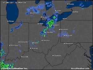 Local radar
" rel="storyimage1" title="NWS-issues-Hazardous-Weather-Outlook-for-area.jpg"/>
Local radar
" rel="storyimage1" title="NWS-issues-Hazardous-Weather-Outlook-for-area.jpg"/>
<br> <img src=http://www.toledoblade.com/graphics/icons/photo.gif> <font color=red><b>VIEW</font color=red></b>: <a href=" http://www.toledoblade.com/apps/pbcs.dll/disp?Category=WEATHER&Maplabel=NXRD_OH" target="_blank "><b>Local radar</b></a>
The National Weather Service has issued a Hazardous Weather Outlook for Lake Erie and Northwest Ohio.
The NWS advises that there is a slight risk that thunderstorms will develop and move across the area today, especially this afternoon and evening. The thunderstorms may become strong to severe. The primary severe weather threat would be from damaging winds.
Today...Showers and thunderstorms likely. Highs around 80. Southwest winds 10 to 20 mph. Chance of rain 70 percent.
Tonight...Showers and thunderstorms likely. Lows in the upper 50s. West winds 10 to 15 mph. Chance of rain 70 percent.
Tuesday...Partly sunny. Much cooler with highs in the lower 60s. North winds around 15 mph.
Tuesday Night...Mostly cloudy in the evening...then becoming partly cloudy. Much cooler with lows in the lower 40s. Northeast winds 10 to 15 mph.
Wednesday...Mostly sunny. Highs in the mid 60s. Northeast winds 5 to 10 mph.
Wednesday Night...Mostly clear. Lows in the lower 40s.