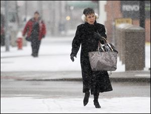
March highs stubbornly below normal temperatures
Month’s second half was especially chilly
4/3/2013
This March averaged 4.2 degrees colder than normal. That was quite a contrast from March, 2012, when Toledo had five 80-degree days during the second half of the month.
Last year, normal April weather felt cold after an extremely warm March. This year, normal could feel warm.
March averaged 4.2 degrees colder than normal, and daily high temperatures averaged 5.9 degrees below normal at Toledo Express Airport, the official National Weather Service reporting station for the metro area.
The month’s second half was especially chilly: Every day from the 16th through the 30th was colder than normal.
That was quite a contrast from March, 2012, when Toledo had five 80-degree days during the second half of the month, including two 85-degree readings that were the warmest on record here for March.
March, 2013, also was a dreary month, with 20 of the 31 days being more than 50 percent cloudy at the airport and precipitation also falling on 20 days, according to the weather service. And on a few days, like last Thursday, it was clearer at Toledo Express than it was downtown because of cloud cover blowing in off Lake Erie.
“We’ve had two extreme years back-to-back,” said Jay Berschback, chief meteorologist at WTVG Channel 13. “It’s so fresh in our minds what last year was like, so it seems colder. ... And we had that one Sunday [March 10] when it got up to 65, and everybody said, ‘OK, well, here we go.’ But it didn't happen.”
What did happen was that the jet stream — upper atmosphere wind currents that steer storms and air masses — stayed to the south, keeping cold air in Toledo and storm centers over southern Ohio, so that two significant snowfalls hit Lima and Findlay but delivered little farther north, Mr. Berschback said.
Toledo’s biggest snowfall of the month was just 1.3 inches, even though snow fell at the airport on 15 different days. The monthly snowfall total of 1.4 inches was 4.3 inches below normal, and brought Toledo’s season total to 22.1 inches, 14.1 inches below normal.
With rainfall for the month also being light, it became the fifth-driest March on record in Toledo, with just 0.73 inch of total precipitation — including the snow’s melted moisture.
While Toledo didn’t get much snow this winter, Mr. Berschback said, there is significant snowpack to the north and northwest that is helping keep air masses over Canada and the Northern Plains states cold. Last spring, he said, even when wind blew from the north in the Toledo area, it wasn’t very cold because there was so much less snow around.
April also has started out cooler than average, and only moderately warmer weather is forecast for the immediate future. After another cool day today, with a high only in the low 40s, the National Weather Service predicted mid-50s highs for Thursday, Saturday, and Sunday, while Friday's high is expected to be around 50.
Normal highs range from 55 today and Thursday to 57 Sunday and Monday.
Sunny weather was forecast for Saturday, followed by showers on Sunday and Monday.