Since finding out that her hillside home is in a floodplain, Susan Bache has been swamped, not with water, but with paperwork.
Because of an apparent error on a new flood map that was drawn by the Federal Emergency Management Agency, Mrs. Bache's home and several other Maumee homes along Harrison Street are now listed in the floodplain area.
During the last few months, Mrs. Bache has been doing everything possible - writing letters, making telephone calls - to draw attention to the problem and get it resolved.
Maumee city officials, who have been working with local residents and federal officials to remedy the problem, say that the mapping error possibly occurred due to crooked printing.
For some reason, the floodplain shifted when the map was updated last year, city officials said. Between 25 to 60 homes along East and West Harrison now are listed in a floodplain, and some residents are being forced to buy flood insurance they say they don't need.
The map has some obvious mistakes, said John Jezak, city administrator. For instance, the elevation of the Maumee-Perrysburg bridge should be high enough to protect it from rising river water, but the map shows that the bridge would be under water during a flood.
Also, the map shows a causeway that doesn't exist, Mr. Jezak said. The Harrison Street homes, by the way, are nestled along a bluff above the Maumee River.
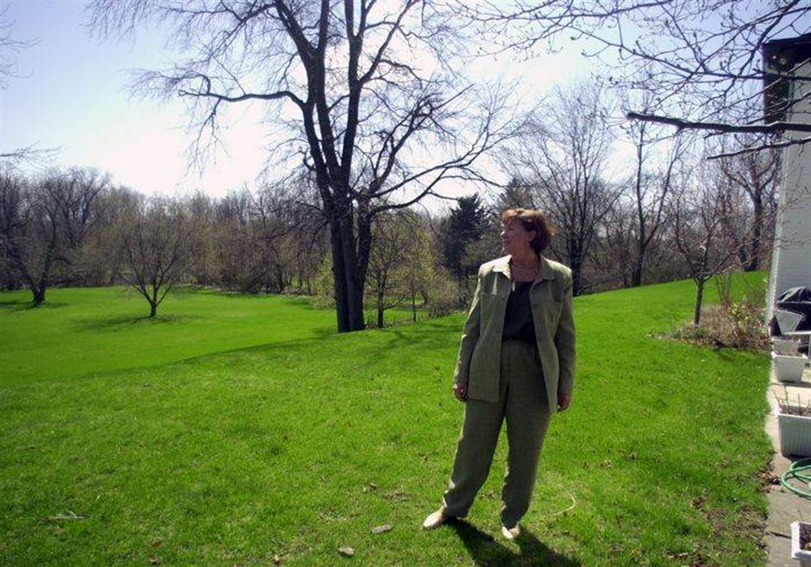
“We don't flood. We are up on a hill,” Mrs. Bache said.
FEMA representatives said that based on information from city officials, revisions to the map could be made, possibly within 30 days.
That would be great news to Mrs. Bache and her husband, Gary Bache, Sr., as well as other Harrison Street residents.
At one point last week, Mrs. Bache had been told that it could take about four months to resolve the issue.
Meantime, residents are continuing to wrangle with their mortgage companies over flood insurance.
City officials sent letters to mortgage companies on behalf of Harrison Street residents, but the letters didn't help in some instances.
Mrs. Bache said that her bank is demanding an official notice of the map revision from FEMA. A telephone call from a FEMA representative wasn't good enough, either, to sway the bank, she said.
Residents are trying to keep the map mistake from turning into a costly problem. The Baches, for instance, were notified last week that they were going to have to pay $1,200 for flood insurance from Lloyds of London - a policy arranged by the bank.
“The $1,200 made me yelp,” said Mrs. Bache. The couple moved swiftly to contact their own insurance representative to buy a less expensive policy, a policy they plan to cancel when the map matter is resolved.
Since December, when she learned that the new map placed her home in the floodplain, Mrs. Bache has contacted several federal officials, including U.S. Rep. Marcy Kaptur (D., Toledo), in an attempt to rattle cages and get some answers. She wrote to her neighbors to alert them to the map problem.
“It's been horrible, terrible,” Mrs. Bache said. “It's been very frustrating. We've had to stamp our feet and we've been constanting calling and saying `what are you doing?'”
FEMA, which adminsters the country's national flood insurance program, is “working with the community and the state to find out what the issues are,” said Eric Berman, civil engineer for FEMA's Region 5.
FEMA has not pinpointed what happened to cause the apparent error, but he said that it seems a few different copies of maps were used in the process to update the map.
Any property that has a 1 percent change of flooding during a storm that happens once in 100 years is considered in the floodplain.
If the map contains errors, FEMA can issue a letter of map revision that residents can send to their lenders, showing that they no longer need flood insurance.
Residents would have to apply for a refund of insurance premiums that they have paid, Mr. Berman said.
The FEMA maps were last updated in the early 1980s. At that time, a similar problem spilled over for Harrison Street residents, said Karen Merrels, whose husband, Andrew, battled with federal officials and got the matter resolved.
Mrs. Merrels, who lives on West Harrison, has vacant property in the bottom land near the river. She wouldn't argue that the bottom land could be considered as floodplain, but her home on the hill? No way. “Something is totally wrong. You'd better build an ark if we are going to flood.”
First Published April 19, 2001, 11:46 a.m.